
價格:免費
更新日期:2018-07-16
檔案大小:30.7 MB
目前版本:1.1
版本需求:需要 iOS 10.2 或以上版本。與 iPhone、iPad 及 iPod touch 相容。
支援語言:英語
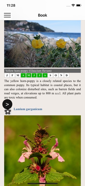
Southern Pelion topoGuide is a digital field guide for hikers and nature lovers visiting Mt. Pelion, Thessaly, Greece. It includes routes, descriptions and photos for 39 hiking and mountaineering trails for the Southern Pelion region, covering the Argalasti and Trikeri areas.
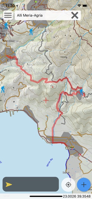
The application offers detailed off-line maps and an extensive introduction on geography, geology, the nature of the southern part of Mt. Pelion area, as well as the rich cultural landscape of some 30 villages.

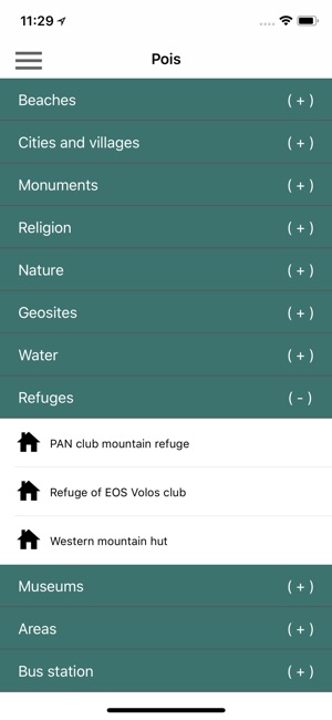
The app offers also a useful list of POIs with a comprehensive search engine.
The trails list includes easy and moderate hiking trails and long mountain traverses, of a total length of 210 km.
In the field, the application identifies the nearest route and make active navigation to it and then along it, with continuous messages to the user, while pops-up photos on every interesting or important terrain feature close to his position. If the hiker position is more than 20 meters far from the trail, the application warns him and suggests how to go back.
The cartographic company AnaDigit, creator of the application, has issued previously detailed hiking maps at a scale of 1: 25,000 for Mt. Pelion, as well as hundreds other hiking maps for Greece (eg. maps of Mt. Olympus, Crete, Zagori, Sifnos, Naxos and other Aegean islands). To build the application and ensuring data accuracy, all paths of Mt. Pelion have been revised during 2017.
支援平台:iPhone, iPad